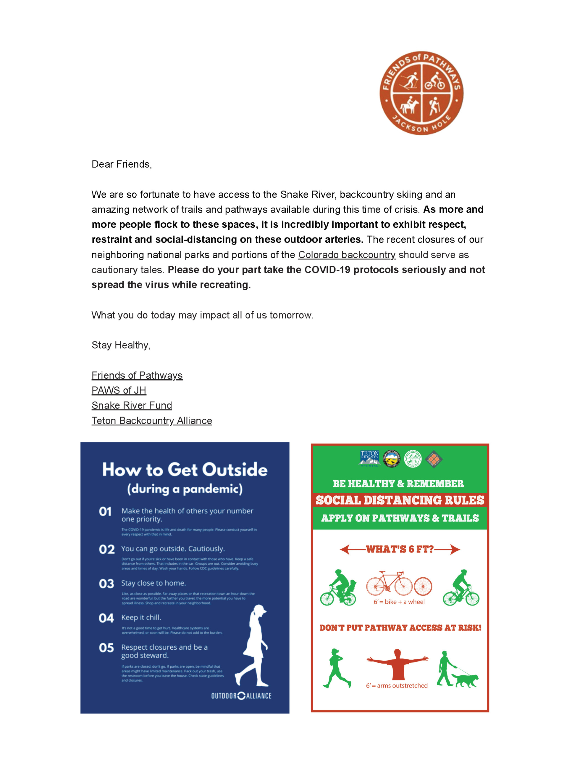
March 31, 2020

Derek Ibarguen, Acting Forest Supervisor

Bridger-Teton National Dorest

P.O. Box 1888

340 North Cache Street

Jackson, WY 83001

Dear Derek,

On behalf of Friends of Pathways (FOP), we are submitting comments regarding the On-Mountain

Improvements Project for Snow King Mountain Resort. FOP has partnered with the Bridger-Teton

National Forest (BTNF) over the last 20 years to build and maintain sustainable trails and promote

good trail etiquette on the 130-mile front-country trail system, including the Snow King area. We

believe that Snow King Resort is an appropriate place to add new trails and improve existing trails to

provide close-to-home access to the national forest.

We support the following improvements proposed by Snow King Resort as they are in keeping with

the BTNF’s desired future conditions and align with a key component of FOP’s mission to promote

healthy recreation in Jackson Hole.

1. Vertical Staircase

FOP supports the staircase trail as a way to consolidate the multiple eroded vertical hiking trails

into one sustainable option that can be used in summer and winter (uphill bootpack). Trail users

continue to create vertical fall-line trails while looking for a more challenging athletic endeavor.

Properly built steps, utilizing rocks or railroad ties, will serve as check dams for runoff and

erosion and give trail users a sustainable option to hike straight up hill.

2. New Summit Trail

If the new Front Access Road is improved, FOP supports the creation of a new summit trail to keep

trail users off of the road where there will be increased construction traffic. This would be similar to

the Wildflower trail at Teton Village. The proposed trail would likely extend above the Shade

Monkey trail and double as the uphill skin track in winter. There are several good alignments

possible, some extending outside of the Snow King permit area into the adjacent BTNF.

3. Re-Route Sink or Swim

If the new Front Access Road is improved, FOP supports rerouting sections of the Sink or Swim trail

to avoid sharing space with a road that will have construction traffic on it. This is not expressly asked

for in the Snow King proposal but we believe it is important for trail user safety. This would likely be

a small reroute uphill of the shared section of trail and road between the current Summit trail and the

ropes course.

4. Downhill Bike Trails

FOP supports lift-served mountain bike trails at Snow King, and believes that adding trail density

within the resort boundaries will be beneficial and help minimize user conflicts on multi-use trails, as

long as mountain bikers using lift access are not allowed to leave the resort boundaries. We

suggest the best way to prevent this is to allow lift accessed mountain bike trails off of the Rafferty

Chairlift only. If this is not feasible, then there needs to be a clear plan for preventing lift-served

bikers from encroaching onto forest lands outside of the Snow King permit area.

In the alternatives of the Draft EIS there are multiple downhill bike trails proposed off the new

summit lift and the new chair lift “A” on the back side of the mountain. In 2015, the BTNF ruled that

no bikes would be allowed off of the Summit lift in the Cache-Game Trail Projects decision memo, to

avoid an increase in downhill specific bicycle use on the adjacent multi-use trail system, including

Skyline, Wilson, Ferrin’s, Summit, and Josie’s Ridge trails. It is especially important that Snow

King’s downhill bike trails do not encourage a person to ride the lift with their bike, only to exit

the resort and ride down the Ferrin’s Trail or Josie’s Ridge trail and back to the Resort. This

would overwhelm a trail system that is already well-used and has a large amount of uphill

walker/biker traffic.

The BTNF analysis of downhill biking impacts states:

Snow King projects that the proposed front-side trails and back-side mountain bike zone will attract 6,000

riders per season within 5 years of completing the proposed trails and bike zone. To ensure a conservative

analysis, we will address 10,000 downhill bikers per season, or an average of 109 per day for a June 1–

August 31 season. Grand Targhee Resort estimates that up to 20 percent of park riders may leave their

downhill trail system to ride a cross-country trail (Williams 2019). If that figure held at Snow King, it would

equate to 22 new riders per day on Cache Creek/Game Creek trails.”

BTNF assumptions are based on two figures which FOP believes are underestimated or need

further evaluation: (1) the daily average number of people using the Snow King lift-service

trails; and (2) the average number of laps or rides that a person will make on those trails.

To get the best estimate for how many daily riders will use Snow King facilities, it would be prudent

to get data from Jackson Hole Mountain Resort before assuming a daily average of 109 riders.

Arguably, Snow King could have superior downhill trails, with more vertical loss than JHMR, so

daily riders may be equal to or greater than JHMR.

To get the best estimate for how many lift-access riders will leave the downhill system, it is critical to

have a more precise daily average figure and to assume that each rider is capable of making multiple

laps per day. Rather than assuming that one rider equates to one ride, the analysis should assume that

one rider could equate to 1-5 rides. This will change the potential impacts to the adjacent trail system

significantly.

Based on the stated time that a ride on the new Summit lift would take and the average downhill

times on Strava for Ferrin’s and Josie’s Ridge, a conservative estimate for a Snow King/Ferrin’s or

Snow King/Josie’s lap would be 30 minutes. This would allow for numerous laps per rider during a

typical day in the summer and more than double, conceivably, triple, the number of downhill trips on

these trails. Currently the Ferrin’s trail sees an average of 68 people/day and Josie’s Ridge an average

of 158 people/day. If an additional 22 riders per day each make 5 extra laps on the Ferrin’s trail, it

will overwhelm the trail and pose a significant threat to uphill traffic.

While the Cache/Game trail system could absorb a limited number of new riders a day, the

Bridger-Teton analysis fails to consider that each rider could take multiple laps via the

chairlift.

In addition to the user conflicts that will result if lift-serviced bikers leak onto the adjacent BTNF trail

system, there will also be a need for increased trail maintenance caused by this increased use. FOP

continues to commit over $200,000 annually to trail building, maintenance, and ambassador outreach

on the BTNF. We are concerned that lift-serviced riders accessing the Cache-Game trail system will

put excessive pressure on our capacity to keep up with trail maintenance and education along this

very popular and well-used portion of the BTNF system.

If the BTNF chooses to abandon the 2015 Cache-Game decision regarding lift-service mountain

bike use on the Summit lift, we ask that enforceable strategies be in place for deterring

“poaching” of adjacent trails BEFORE the downhill trails are built. Snow King will need to

invest the necessary funds to build the physical infrastructure and retain sufficient staff to ensure that

lift riders are cognizant and compliant of the rules. Snow King has said they would implement a plan

to pull passes if people left the resort area on bikes. This can very difficult to enforce without

sufficient on-the-ground resources, similar to how skiers continued to leave the Jackson Hole

Mountain Resort boundaries until finally an open gate policy was implemented.

5. Rehabilitation and Weed Mitigation

Please require proper rehabilitation of trails and roads slated for closure. There is a network of usercreated

and Snow King-created trails that need to be properly rehabilitated before new trails are

constructed. This is a vital part of keeping trail users on the legal and sustainable trails and integral to

the overall health of the forest. Snow King must be held to a high standard of compliance with

invasive species mitigation. Past projects on Snow King have resulted in infestations of noxious

weeds which have quickly spread up the popular Summit and Shade Monkey trails onto the national

forest.

Friends of Pathways whole heartedly supports adding new hiking and biking trails to Snow King

Mountain. This aligns with the USFS desires to provide close to home access to the national forest

and concentrate future trail development in places where a high level of impact has been established.

We hope that the BTNF will choose aspects of this plan that improve both Snow King and the front

country trail system while not adversely affecting the overall trail community.

We have included a map of a trail development scenario for Snow King that we believe is best suited

for approval. This was initially prepared as an alternative that was in keeping with the 2015 Cache-

Game Decision Memo but was altered into the current Alternative 4.

Thank you for your support over the years and for your consideration of our comments.

Sincerely,

Chris Owen Katherine Dowson

Trails Program Manager Executive Director

Friends of Pathways Friends of Pathways

FOP Proposed Trail Development Map for Snow King Resort

The following is the letter submitted by Friends of Pathways to Wyoming Game & Fish Department in support of a proposal by Wyoming Untrapped to prevent trapping at popular trailheads in Teton County.


April 2, 2020

Wyoming Game & Fish Commission

c/o Sheridan Todd

5400 Bishop Blvd.

Cheyenne, WY 82006

RE: Trapping restrictions on popular trails in Teton County, WY


Dear Wyoming Game & Fish Commissioners,

I am writing on behalf of Friends of Pathways (FOP), a local non-profit in Teton County, WY that,

among other things, promotes healthy recreation through a robust trail stewardship program on the

Bridger-Teton National Forest (BTNF). FOP works under an MOU with the BTNF, providing trail

building, maintenance, and education services on Jackson’s close-to-home trail system, including

Cache/Game, Teton Pass and Munger Mountain areas. Our organization dedicates over $200,000 a year

to ensuring that these areas are well-maintained and accessible to a wide-range of activities – including

hiking, biking, dog-walking, skiing and horse-back riding. Through volunteer, seasonal and yearly staff,

as well as an 8-person Youth Trail Crew, FOP works to keep Jackson’s most popular trails sustainable

for both wild and human neighbors.

I understand that the WY Game & Fish Commission is reviewing regulations for the Jackson area at a

Commission meeting in April. Please consider amendments to WYG&F trapping regulations at that

time, instead of waiting until 2022. FOP supports any actions by the WYG&F which would result in

restricting trapping from popular trail systems in Teton County. User data collected by FOP from

June 1-August 31, 2019, through permanent and mobile counters along trails in the Cache/Game and

Teton Pass areas, showed a daily average of 3,962 counts, or 1,981 people using these trails (see

attached). In all likelihood, this figure is a low representation of the daily number of people that are

walking dogs, running, mountain biking, and getting out to enjoy the recreational experiences, nature,

and scenery that these trails provide. While trapping may be a compatible use in other areas of the

BTNF, it should not be allowed in areas where pets and people congregate. Just as certain areas of

the BTNF are restricted from motorized, extractive, or recreational uses, trapping should be limited to

areas that don’t have high traffic volumes or invite conflict. Please don’t let the actions of a very few be

prioritized over the safety and well-being of thousands of people and pets in Teton County.

Thank you for your consideration and for the work you do on behalf of the people and wildlife of

Wyoming.

Sincerely,

Katherine Dowson, Executive Director

Friends of Pathways

Pathway Plowing Updates
March 30, 2020

  • Parks and Rec started clearing the 3 Creek section of pathway on Sunday, March 29th. It will likely take a couple of days to get all of the snow removed.
  • The Moose-Wilson/390 pathway from Lake Creek to the Village will start getting plowed this coming week as well.

Don’t put pathway access at risk! Obey pathways usage guidelines during Coronavirus. 

  • Maintain 6 ft. of separation between users at all times!
  • We encourage everyone to travel at a safe speed and make sure you give other pathway users a comfortable amount of space, especially with the current concerns about COVID-19 and social distancing.
  • Travel on the right half of the pathway, pass on the left—and only when it’s safe to pass with no oncoming traffic.
  • Faster riders yield to slower users—it is always the responsibility of the faster-moving user to pass safely.
  • Signal audibly BEFORE passing. Ring your bell or say “on your left” and make sure the person has heard you and knows you’re passing.
  • Travel at a safe speed. Watch out for little kids, older folks, and less experienced users who may be less predictable and less steady on their feet or bikes.
  • Be alert. Keep an eye out for users approaching from behind, and make sure you can hear and respond to others on the pathway (mind the ear buds!)
  • Don’t block the trail. If you’re with a group, make sure to stay on the right half of the pathway. When stopped, please step completely off the side of the path and keep the trail clear for other users.
  • Keep dogs under control and clean up after pets. Dogs are required to be on leash on Town of Jackson pathways and under voice control on County pathways. Please bag AND DISPOSE OF your dog’s waste using the Mutt Mitts and the many trash cans provided for your convenience.

With so many people out on the pathways right now, a lot of whom might not regularly use pathways and are perhaps a little rusty on their pathways etiquette, Friends of Pathways and the Jackson/Teton County Pathways program would like to remind the community of pathways usage guidelines that help keep all users safe and make sure everyone has an enjoyable experience on our community trails.

Pathways Usage Guidelines during Coronavirus (and all other times too)

  • We encourage everyone to travel at a safe speed and make sure you give other pathway users a comfortable amount of space, especially with the current concerns about COVID-19 and social distancing.
  • Travel on the right half of the pathway, pass on the left—and only when it’s safe to pass with no oncoming traffic.
  • Faster riders yield to slower users—it is always the responsibility of the faster-moving user to pass safely.
  • Signal audibly BEFORE passing. Ring your bell or say “on your left” and make sure the person has heard you and knows you’re passing.
  • Travel at a safe speed. Watch out for little kids, older folks, and less experienced users who may be less predictable and less steady on their feet or bikes.
  • Be alert. Keep an eye out for users approaching from behind, and make sure you can hear and respond to others on the pathway (mind the ear buds!)
  • Don’t block the trail. If you’re with a group, make sure to stay on the right half of the pathway. When stopped, please step completely off the side of the path and keep the trail clear for other users.
  • Keep dogs under control and clean up after pets. Dogs are required to be on leash on Town of Jackson pathways and under voice control on County pathways. Please bag AND DISPOSE OF your dog’s waste using the Mutt Mitts and the many trash cans provided for your convenience.

We are truly fortunate to have such a connected and accessible pathways system that allows people of all ages and abilities to travel and recreate safely and enjoy some time out of the house. While we’re all coping with the impacts of COVID-19 on our normal daily routine, we remind the community to expect to see many more users on our pathways than usual and to please remember that many of them may not have a lot of experience on shared-use paths. And we encourage everyone to travel safely and be patient and respectful toward your fellow path users.

We will be posting pathway plowing and sweeping updates as often as possible on this page and on our Facebook page.

Pathways maintenance personnel will be focusing on the winter-to-spring transition over the next several weeks, which includes sweeping sections that were plowed during the winter and clearing snow off of sections that were groomed for the winter season. Pathway users should use caution and watch out for icy sections due to snow melt and refreezing (especially during the morning hours), for gravel patches that may make corners slippery, or for other hazards that may exist during the transition to spring conditions. Check out the winter map HERE to see which sections were groomed or plowed this winter.

In addition, FOP’s winter single-track grooming in Cache Creek, will continue as long as weather permits, or until March 28th. The trails are holding up fairly well but please avoid hiking or riding during the warmest parts of the day if possible. If you are leaving a trench or divot more than 2” deep you are damaging the trail surface.

As always, please demonstrate good pathways and trail behavior by passing slower users safely, ringing your bell when passing, picking up after your pet, and obeying traffic rules. And, during this time of social distancing, we can all help out by making just a little added effort to slow down and give everyone extra space when traveling on pathways.

Lastly, please remember that social distancing recommendations still apply on pathways and trails, and that if you’re coughing and/or feverish, please rest, self-quarantine, and seek medical advice.

With the weather this weekend it seemed like a good time to remind people about when not to use the trails.  Our trails hold up well to the amount of use they get and because they get so much traffic they tend to be very compressed and shed water well, especially with the 1000’s of drainage features we have installed and clean out each year.  Because of this my rule of thumb is after it rains, if the roads in town have dried out, the trails are good to go.  That comes with some caveats.  Another thing I look at is the total rainfall, usually 0.3 inches of rain in a 24 hour period is what the trails can handle before they get saturated.  So if it rains hard 3 days in a row the trails might be muddy for a bit longer.  Then when you throw colder temperatures into the mix things get tricky.  When there is a good freeze thaw cycle each day the trails tend to be good/frozen in the morning, followed by a thaw period where the top frozen layer of dirt gets really slimy, you know that kind of mud that sticks to everything.  Then if its sunny, by the afternoon they tend to dry out and be at a good tacky consistency.  With all of this use your own judgement and be aware of what activity you are doing on the trails.  While you may be able to use a trail on foot or bike shortly after a storm, riding a horse may have more impact and it may be better to stay on the roads where the surface is more compact and rocky.  In general take the time to look behind you and see what type of tracks you are leaving and think of the poor trail workers who have to fix those foot prints, hoof prints, and tire ruts.  So get out this afternoon while its nice and if you’re looking for a rainy day project on Saturday morning come out to Wyoming Public Lands Day and volunteer at one of the many projects around the valley.

Over the last 2 weeks we have been busy taking care of a bunch of small projects including clearing trees off of the Skyline, Game, West Game, and Wilson Canyon trails.  We have been brushing, fixing signs, looking for signs (if anyone knows the whereabouts of the Lithium sign I would very much like it back), and helping Jim Verdone and Evans with the Old Pass Road paving.  The partnership with Jim and his work on maintaining the OPR over the years has led to amazing improvements to make sure this valuable piece of pathway remains usable for the future.  Evans crews paved the upper section from Crater Lake to Teton Pass over the last 3 days.  Additionally we have been working on the next batch of improvements for the Blair Dr. Bike Skills Park.

Finally something we have been working on for the last 5 years is data collection on the trails and pathways.  We have been using EcoCounter units that have a small beam that counts travel in both directions and we have been working to get a solid number for how many people use the trail systems on Snow King and Teton Pass each day.  The numbers above are from our summer counts (June 1 – August 31) and are an average of the past 5 years.  Each counter gives a total count and shows a percentage of people going in to the forest and out back to the trailhead.  Since the overall percentages are almost equal to 50% in and 50% out you infer that almost everyone is entering and leaving the forest on the same day.  This means if you divide the total count by 2 you get the number of people using the forest each day.  We have been using old monitoring data from the BTNF that showed while the 130 miles of frontcountry trail systems that Friends of Pathways maintains only make up 18% of the total trail mileage on the Jackson Ranger Distrcit, they see 84% of the use.  The numbers we found from these counts indicate that percentage might be even higher.  The trails around Snow King within the circle formed by Cache Creek and Game Creek saw 1,526 users per day while the Teton Pass trail system saw 910 users per day on average over the summer.  This is why Friends of Pathways contributes $250,000 a year to the maintenance of the frontcountry trail system, to try and provide maintenance equal to the amount of use the trails get.  If you enjoy the great access we have to high quality trails consider donating to Friends of Pathways at Old Bill’s to help us continue on the 20 years of trail work we have done with the Bridger-Teton.

The last 2 weeks were busy ones.  The youth trail crew finished up their season by clearing trees off the ridge trail with Randy, then they cleaned all the drains on the Big Rocks trail.  After that they built a turnpike in Black Canyon, braced the kiosk at the Trail Creek trailhead, and shored up the center support on the Crater bridge.  They also worked with 2 volunteer groups to extend the Blair Dr. Kids Bike Park singletrack and add some fun skills features.  We were sad to see this great crew leave to go back to school, this has left myself and Mike Piker on and we spent this week clearing trees off the Skyline, Hagen, Phillip’s Connector, and Arrow trails.  We have also been working diligently to collect trail use data at all the trail access points to the Bridger-Teton around Snow King (23 access points) and Teton Pass (13 access points).  Hopefully when compiled this will give the BTNF a better picture of how many people use the national forest trails each day and hopefully result in some more trail funding for these popular areas.  Hope to see everyone out on trails this weekend, swing by either the Bikes, Baskets, and Brews event at JHMR or the Pass Bash at the Stagecoach!

This week the crew worked on rebenching some switchbacks on the Ferrin’s Trail and breaking off the corner of the Ferrin’s Rock.  After a hearing more stories of bike crashes there (handlebars are getting wider right?) and having to try and shore up the half bench trail that dips under the rock on a steep side hill several times over the last few years we finally let loose the raw energy of the youth trail crew on it.  Turns out a half dozen people sledge hammering on a boulder can break off a foot or two of rock in a few hours.  The crew then reenforced the cribbing and leveled the trail out with all the rubble and dirt so the whole corner is much more sustainable now.

The crew then moved to a section of braided trail on the KC trail and closed and rehabbed the lower trail which had eroded into a gully.  They then added check dams to the lower trail to prevent erosion, tilled up the old trail, reseeded it, and covered it with erosion netting made from shredded Aspens.  Then they rebenched the upper trail and added drainage features to make sure it won’t form a gully like the old one.

Next the crew moved up to the History Trail to clear a large tree and build a turnpike on a boggy section of trail.  The crew extended the turnpikes that the Boy Scouts built in 2008 and channeled the water under the trail in a culvert and dug a large Y ditch to catch the water seeping from above.  They finished it off by peeling guide logs, staking them in place, and filling the whole thing with gravel to raise the level of the tread.  The crew finished up the week by working on the new East Table take out trail.  This new trail was built to replace the old take out trail that was on a very steep side hill that was slumping.

Also this week the new layout of the Big Munger trail was connected by the members of DIRT who are working as Crosscut Trails and Forestry.  The 4 new reroutes on the southern leg of the Big Munger trail removed the 30-45% eroded sections of the trail that went straight up the hillside.  When myself and Tim Farris laid out the trail we did so with the sustainable grade of the soils at Munger Mountain in mind.  This also means the new trail is much more accessible by Mountain Bikes and specifically E-Mountain Bikes which are allowed on the Munger trails from July 1 to September 9 each year.  The project will continue to touch up the trail and rehab the old eroded sections of trail and will move the the northern leg of the trail next year to make the loop to the top of Munger Mountain much more enjoyable by all.  Head out that way this weekend and enjoy the new section of trail!


This week the crew worked with another great volunteer group from the Beckett YMCA for 2 days on the West Game trail.  They built a turnpike and a small reroute at a seasonal runoff between bridge 3 and 4.  They also built a causeway to raise the approach to bridge 3 above the creek which has formed a small oxbow bend right beside the trail in recent years.  The crews split and cleared some downfall on the Hagen Highway, Black Canyon, Arrow, and Ridge trails from the winds that blew through over the weekend.  The Black Canyon crew also cleaned 98 drainage features on their hike to help get water off the trail and prevent erosion.  They also got to practice crosscutting while clearing the Goodwin Lake trail up to Jackson Peak with one of the Wilderness Rangers.  The trails should be in great shape with the rain from last night.  Be sure to get out to the Rendezvous Hill Climb at JHMR on Saturday and stop by the Pass Bash at the Stagecoach afterwards.